
APPLICATION
?

Aligning 3D Data Captured from UAV and Handheld Mobile LiDAR
Data set alignment also referred to as co-registration, can be quickly carried out using GreenValley's LiDAR360 point cloud processing software.
Date: 31-July-2020

Extracting Individual Tree Metrics from Forest LiDAR Data
Leverage LiDAR360 processing software to generate geospatial products from mobile, terrestrial, UAV or airborne systems that meet critical needs of foresters.
Date: 31-July-2020
?

Urban Power Line Management
A previous article showcased GVI solutions using UAV LiDAR for high-voltage transmission line survey. We now turn to another question, what about using LiDAR to inspect power distribution lines in urban neighborhoods?
Date: 31-July-2020

Power Line Corridor Management
Using LiAir Series and LiDAR360's Power Line module to detect hazardous vegetation overgrowth along the transmission lines and pylons.
Date: 31-July-2020

Calculating Sand Bulk Volume of Sand Barge using LiDAR
Date: 31-July-2020

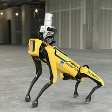
Productivity Reimagined, For The Win
The construction industry might be the last place you’d think to look for state-of-the-art use of technology, but considering globally it’s a US$10 trillion industry, it’s absolutely where productivity leaps pay off in massive gains. Swinerton is demonstrating that construction ......
Date: 31-July-2020

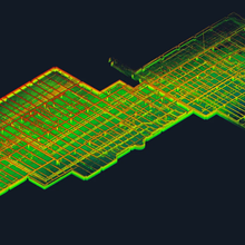
Remote Access
The challenge. How to capture a hospital’s large crawl space consisting of an intricate maze of low-hanging pipes, conduit, and other complex mechanical systems, with a vertical clearance between 1.2 meters (4 feet) and 0.3 meters (1 foot), in the sweltering summer heat? ......
Date: 31-July-2020

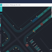
Visualizing Curbside Use And Occupancy
The 3D data generated by Kaarta’s products can be utilized in a range of mapping applications. For example, Allvision IO, a company specializing in extracting and analyzing high frequency data for mobility insights, utilizes the Kaarta platform in its Parkview solution, which ......
Date: 31-July-2020

A Modern Approach To Mapping Ancient Pompeii
The silver lining to the calamity befallen upon the ancient city of Pompeii – notoriously buried in a thick carpet of volcanic ash and pumice with the eruption of Mount Vesuvius in AD 79 – was the preservation of the Greco-Roman buildings and artifacts, providing insights into ......
Date: 31-July-2020

Faultless Failure Measurements
Lidar data has been an integral asset for natural resources management since the early 2000s, across many terrestrial disciplines including forestry, ecology, wildlife, geology, geomorphology, surface hydrology, and land use planning. For the most part, large-scale projects ......
Date: 31-July-2020

Smarter Street Level Data
Due to ongoing urbanization and growth, the UN projects that nearly two-thirds of the world’s population will live in an urban area by the year 2050. New challenges are emerging for our urban centers as growth continues and cities struggle to manage integrated infrastructure .....
Date: 31-July-2020

Scoot Over: A Clever Method For Mobile Street Mapping
When Bogdan Boroianu and his company GeoCad were tasked with providing comprehensive maps of a street network near their offices in Bucharest, Romania, several options were available for mapping the area. The most ......
Date: 31-July-2020

Bridging The Gap Between Aerial And Terrestrial Mapping
The beautiful hilltop town of Mondovì in the Piedmont region of Italy required a full 3D model of the area surrounding a proposed bridge construction project. A roadway runs on one side of the ravine. On the other ......
Date: 31-July-2020

Electrifying 3D Scans Courtesy Of KAARTA
GeoMar, a mapping and surveying company, was tasked with providing a precise and detailed inventory of the right of way (ROW) for an electricity transmission supplier. Not only do assets such as wires, roads, bridges, railways, buildings, and vegetation need to be inventoried but ......
Date: 31-July-2020

Flat-Out Better Scans For Flat Spaces
A mobile mapping system that simultaneously localizes and maps (often referred to as SLAM) uses 3D features to know where it is and what’s around it, and builds a map from that information. Typically, 3D scanners will struggle in a flat and featureless
Date: 31-July-2020

Pay Dirt: Fast And Easy Verification Of Material Removal
Stockpiles are scanned for a variety of reasons, mainly to determine the volume for monthly, quarterly, or annual inventory auditing. A construction company needed a volumetric analysis performed at one of their sites ......
Date: 31-July-2020

From Capture To Cadastre In A Flash
The ANCPI (National Agency for Cadastre and Land Registration of Romania) provides oversight for cadastral and property inventories throughout Romania. For each new (or renovated) urban parcel, a detailed as-built floor plan must be supplied to the ANCPI to verify ......
Date: 31-July-2020

A Model Senior Citizen
Renovation plans were underway for a 250-year old hospital in Romania. To complete the design phase of the renovation, the architectural firm needed accurate spatial data of the existing conditions. The problem? The working hospital is large (15,000 square meters/160,000 square ......
Date: 31-July-2020

Can’t See The Forest For The Trees?
Densely wooded areas are notoriously challenging for localization and mapping. So when Kaarta was asked to demonstrate the performance of its mobile real time 3D scanning technology for an innovative application, that’s exactly what they did. With just a 30-minute walk ......
Date: 31-July-2020

Charminar
The Charminar ("Four Minarets"), constructed in 1591, is a monument and mosque located in Hyderabad, Telangana, India. The landmark has become a global icon of Hyderabad, listed among the most recognized structures of India. Charminar has been a historical place with ......
Date: 31-July-2020

Commercial Real Estate Office Space Planning
Two separate scans of a office complex set in the context of a city block with mixed retail, parking, restaurants and busy thoroughfare. Interior scan by Contour in 20 min. Exterior scanned with Stencil in under 30 minutes, included roof access and no aerial to provide ......
Date: 31-July-2020

A Herculean Effort For Conventional 3D Modeling, But Not For KAARTA
Date: 31-July-2020
In service for more than a half a century, the legendary C-130 Hercules lives up to its name -- capable of airdropping 42,000-pound (19,000 kg) loads and transporting oversized cargo ranging from utility helicopters and Humvees ......
.png)