

NEWS
?

Kaarta announces Stencil Pro: SLAM mobile mapper with integrated 360° color and GNSS
On the recent SPAR 3D webinar, Kevin Dowling, CEO of Kaarta made a surprise announcement: Kaarta has a new SLAM-based mobile mapping sensor – The Stencil Pro – and its unlike anything we’ve seen previously in the ......
Date: 31-July-2020

Automated with Velodyne Ecosystem Partners are Driving Autonomous Innovation
Date: 26-June-2020
Video highlighting companies that have recently joined the Automated with Velodyne ecosystem program to commercialize lidar-based autonomous solutions.
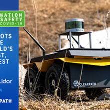
Top 3 Takeaways from the Velodyne – Clearpath Robotics Webinar
Date: 14-June-2020
In a webinar with Velodyne Lidar, Ryan Gariepy of Clearpath Robotics discussed how autonomous mobile robots are tackling the dirtiest and deadliest jobs.
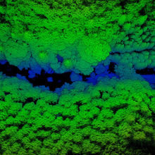
Mapping the Inaccessible with Lidar
Stefan Hrabar of Emesent discusses mapping with lidar using Hovermap, equipped with Velodyne’s Puck LITE™ lidar, in infrastructure, mining, & forestry.
Date: 08-June-2020

Robots Supporting COVID-19 Response and Public Health
Date: 05-May-2020
Velodyne Lidar has been forming partnerships with customers who are using lidar in applications for robots supporting COVID-19 pandemic response.
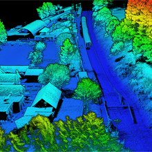
Lidaretto 3D Scanning System Captures Accurate, Reliable Geospatial Data from Any Location
Date: 09-April-2020
Geotech’s Lidaretto 3D mobile surveying system uses Velodyne Lidar Puck™ sensors to produce highly accurate point clouds for a variety field applications.

Lidar Technology Safeguards Privacy in Smart City Applications
Date: 28-January-2020
Cities are embracing smart city technologies and their resulting data to power a range of solutions that address challenges like…
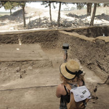
Wheaton College Archaeology Team Uses Velodyne Lidar to Preserve the Past
Date: 28-January-2020
Lidar technology is being used to understand and preserve the ancient world. Students of the Wheaton College Archaeology Program, led…

Lidar Technology Making Smart Cities a Reality
Data set alignment also referred to as co-registration, can be quickly carried out using GreenValley's LiDAR360 point cloud processing software.
Date: 06-December-2019

A Guide to Lidar Wavelengths
An overview of lidar wavelengths, including a comparison of 905 nm vs 1550 nm lidar when considering safety, water absorption, and technology components
Date: 06-November-2018
Progression of LiDAR and UAV through 2016
Broad UAV Market Trends The industrial drone market has evolved at a phenomenal pace over the last 12 months. Drone…
Date: 05-December-2016

LiDAR for UAV: Solar Power Inspection
Solar power accounts for an estimated 30GW of renewable electricity generated in the US. This number is growing each year…
Date: 30-November-2016

LiDAR Mapping in Archeology
Archeologists uncover pre-historic mysteries so humans can understand the past. Traditional archeology requires hundreds of man-hours poring over old documents…
Date: 29-September-2016
.png)